Moabi Previewing at SotM-US
Update: we had an excellent time at SotM-US and the Sprint day. The presentation slides and video are now posted.
The Moabi development team is excited for State of the Map US this weekend. We are sharing a preview of the new Moabi (to be fully launched on Earth Day), and presenting our work on Sunday at 4pm, OpenStreetMap as Infrastructure, sharing the stage with the USGS National Map Corps project, and NPS Park Tiles. Hope to see you there! And if you want a demo any time this weekend, find one of the team, Sajjad, James, Leo, Chippy (virtually) and myself.
First why Moabi?
Moabi-DRC is an independent mapping initiative that collaboratively monitors land use in the Democratic Republic of the Congo. Our community works towards a more Transparent, Equitable, and Sustainable future for the environment and people of DRC. You can use Moabi DRC to explore, share, and create projects on a wide range of issues from REDD+ to community mapping and more.
Why OSM as Infrastructure?
OpenStreetMap’s render stack, editor and web application can be used to power collaborative mapping efforts beyond OpenStreetMap. OpenStreetMap’s software is unique and powerful as infrastructure for building communities of contributors. What happens when OpenStreetMap software is reused for new data sets and communities beyond OpenStreetMap.org?
We’ve been working on customizations like…
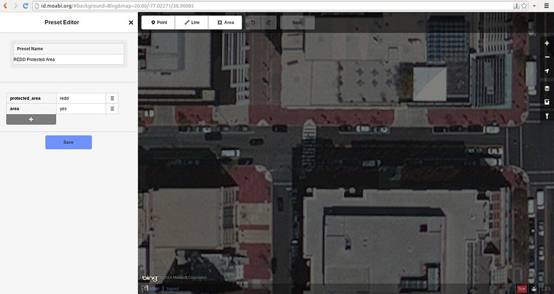
Preset Editor for iD
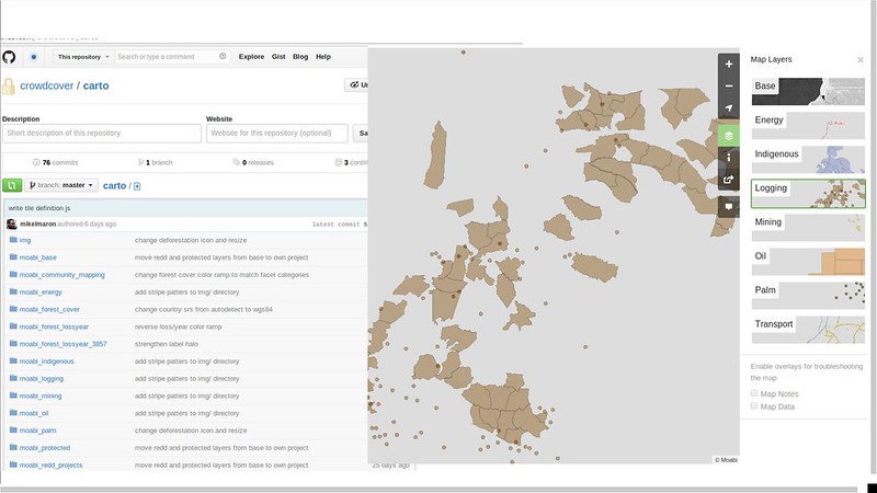
Tile management through GitHub and a OSM TileAPI
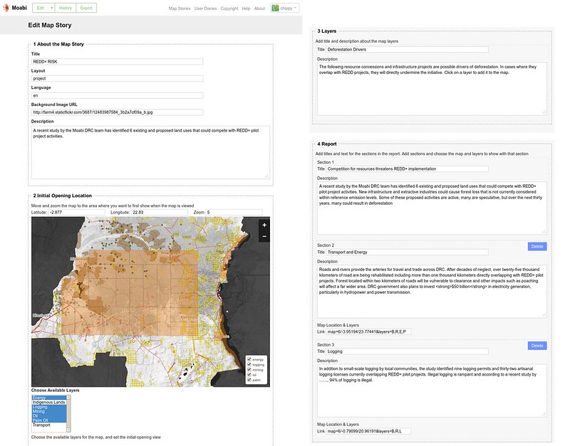
Map Story Building in OSM
Showcase Map Sites in Jekyll/GitPages
So much more this weekend, see you!